To build your own Itinerary, click  to add an item to your Itinerary basket.
Already saved an Itinerary?

![]()
![]()
![]()
![]()


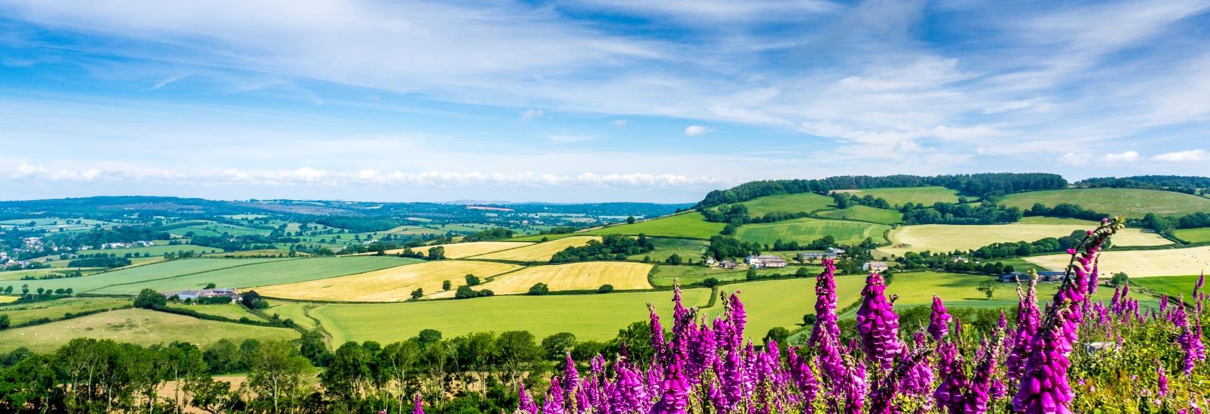
The new South Hams Way is a 100 mile hiking trail that circumnavigates the South Hams area of South Devon. The route is divided into ten sections of roughly 10 miles each following existing footpaths, lanes and byways. The sections are deliberately centred on community hubs where there is public transport access, shops, refreshments and accommodation.
Created for walkers by South Hams Ramblers, it travels through four very different types of landscape and terrain including moorland, coast paths, estuaries, river valleys and countryside. Its highest point is 1,281ft, just above the Avon Dam reservoir on Dartmoor, and its lowest is sea level.
Along the way discover:
Fifty miles of the South West Coast Path. From Noss Mayo in the west, along to Salcombe and onwards to Dartmouth in the east.
The wilds of Dartmoor National Park to the north, so different it is like stepping into another country.
The South Devon National Landscape comprising deep green valleys between soft rounded hills, native hardwood forests and rivers extending from springs on Dartmoor all the way to our estuaries.
Five lovely estuaries, all different in nature. The Yealm at Noss Mayo, the Erme at Mothecombe, the Avon at Bantham, the Kingsbridge and Salcombe estuary and the Dart at Dartmouth.
1000 years of history in our villages, hamlets and market towns. Totnes, the heart town of the South Hams is famed for its independent shops and numerous listed buildings, including a 16th century guildhall and a motte and bailey castle built early in the Norman Conquest.
Walking and spending time in nature offer a wide range of physical, mental, and emotional health benefits. The trail provides opportunities not only for long-distance walkers but also for visitors and residents to enjoy walking as a means of exploring and discovering the best of the South Hams region. The trail is free for all to follow and you don’t have to be a member of the Ramblers to walk it.
Go to the website for all details of the trail including maps, GPX files for navigational apps and route guides to download or follow on your smartphone.
| Season (1 Jan 2026 - 31 Dec 2026) |
|---|
View
Close
The European Agricultural Fund for Rural Development: Europe investing in rural areas has supported Visit South Devon CIC to develop online destination marketing
© Visit South Devon Community Interest Company Ltd 2009 - 2026, Company Number 06891935